The territorial jurisdiction1 of the Association as a member of the NATIONAL ASSOCIATION OF REALTORS® is provided in two formats:
Map of Jurisdiction
Written Description
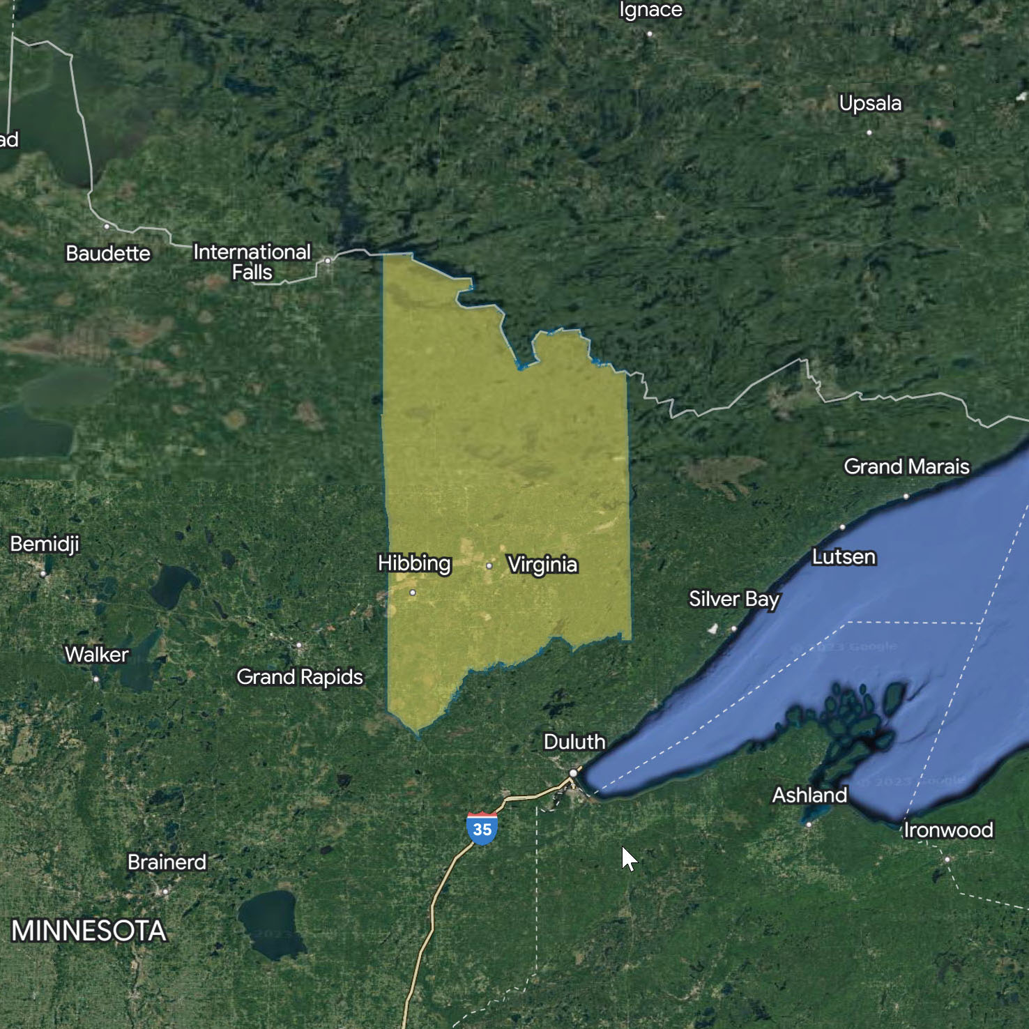
St. Louis County, State of Minnesota
SOUTHERN BOUNDARY: Beginning in St. Louis County at the intersection of Highway #2 and the St. Louis County line, then proceeding Northeasterly using the Whiteface River to the Whiteface Reservoir when it joins Highway #4, proceeding Southeasterly along Highway #4 to the intersection with Secondary Highway #547 to the Village of Brimson and Secondary Highways #44 and 14, thence Southeasterly to the St. Louis – Lake County line.
EASTERN BOUNDARY: Beginning at the intersection of the St. Louis – Lake County
line proceeding Northerly using this line as the boundary to the border of the U.S. and Canada.
NORTHERN BOUNDARY: Beginning at the intersection of the St. Louis – Lake County and the U.S. and Canada border proceeding in a Westerly direction using the U.S. And Canada border as boundary to the intersection with the St. Louis – Koochiching County line.
WESTERN BOUNDARY: Beginning at the intersection of the St. Louis – Koochiching
County line proceeding Southerly using the St. Louis – Itasca and St. Louis – Aitkin County line as boundary to the point of beginning at the intersection, all in St. Louis County, State of Minnesota.
1Territorial jurisdiction is defined to mean:
The right and duty to control the use of the terms REALTOR® and REALTORS®, subject to the conditions set forth in these Bylaws and those of the NATIONAL ASSOCIATION OF REALTORS®, in return for which the Board agrees to protect and safeguard the property rights of the National Association in the terms.